Satellite Tracking | Mango

|
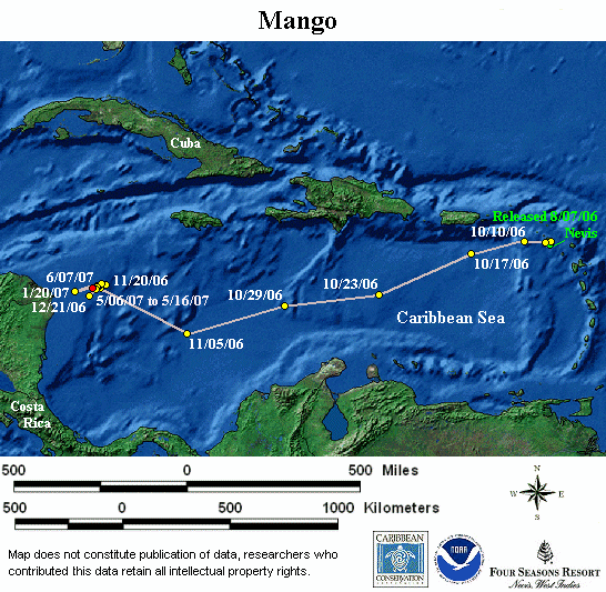
Cumulative distance traveled: 2,249 km (1,398 miles)
Distance covered since last location: 2 km
Straight line distance: 1,009 km
Cumulative Distance refers to how far the turtle has actually travelled since it was first tagged. Straight Line Distance refers to the distance between where the turtle was first tagged and its current position in a straight line.
|
|
Notes: Since her release, Mango has traveled arcoss the Caribbean Sea to her feeding ground, a coral reef system off the Miskito Coast of Nicaragua. She is about 130 km (81 miles) south of Calypso’s last known location! Sea floor depth is less than 200 m.
|
|
 |
Please note: The presentation of data here does not constitute publication, and the researchers who contributed this data retain all intellectual property rights.
|
This map is updated with new points as soon as they are received by the Sea Turtle Conservancy. The red location point on the static map is the most recent location received for this turtle. If the red point is more than two months old, then the transmitter is most likely no longer working.


